May 27, 2026
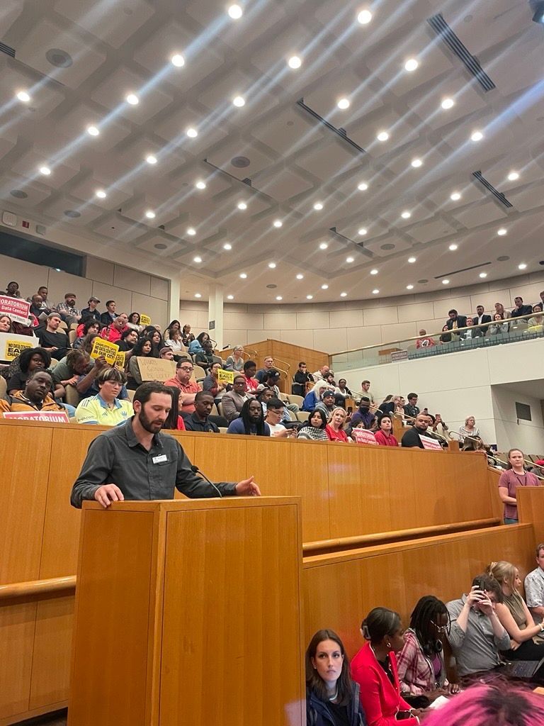
On the evening of May 26th, 2026, Catawba Riverkeeper Brandon Jones attended the Charlotte City Council Public Meeting. At this meeting, he shared our organization's comments on the proposed 150-day data center moratorium. These comments can be read below. "The Catawba Riverkeeper Foundation is a member-funded environmental nonprofit that educates, advocates, and protects the Catawba-Wateree River and all its tributaries. Our organization represents over 8,000 active members and nearly 3 million citizens who rely on the watershed for drinking water, recreation, and electricity. We are concerned that the growth of local data centers may overallocate our limited resources and decrease our ability to respond to drought. We appreciate the opportunity to comment on the proposed 150-day moratorium and strongly support the staff's recommendation to adopt it. Additionally, if adopted, we recommend that the study consider a tiered approach, transparency, and net water consumption. For our water resources, the most important data center metric is net water use. A 400 MW facility—like the one now under construction on Moores Chapel Road—may actually evaporate more water indirectly than directly for cooling. The nearby Catawba Nuclear Station uses approximately 30 MGD to produce 2,300 MW or 5.2 MGD from Lake Wylie per 400 MW. However, without transparency and reporting, it is difficult to know the current impact of these data centers and almost impossible to accurately forecast the industry's future. The most accurate forecast of our region's water resources is the Catawba Wateree Water Management Group’s 2026 Integrated Water Resources Plan. Unfortunately, this plan explicitly does not include increases in water use from data centers due to limited reliable information. It is absolutely critical that our community has accurate information. We need full transparency on the planned electrical and water use of large data centers. A ban of nondisclosure agreements between elected officials and developers could help alleviate suspicion and allow communities to make informed decisions about tradeoffs. The potential direct and indirect impact s of a project should be modeled by the CWWMG to determine its actual impacts. Those impacts could be mitigated by funding water conservation projects, as some data centers have already proposed. Once operating, we need reporting on the actual water and energy use. The cumulative impact must be understood to ensure capacity and resiliency. Water withdrawers from the Catawba utilize a Low Inflow Protocol during drought to help stretch the available supply. Large data centers need conservation plans that comply with this plan. It is hypocritical to ask residents and some businesses to restrict water use while permitting facilities that cannot or will not do the same. Most years, there is plenty of water for drinking, irrigation, ecological flows, and industry in the Catawba. However, droughts such as 2001, 2007, and today expose our vulnerabilities. These droughts are more likely in a warming climate, and we are becoming less resilient with a growing population and industrial demands. Sustainable water management requires careful planning and robust coordination between users, including data centers."