Swim Guide

August 25, 2022

Is it safe to swim here?

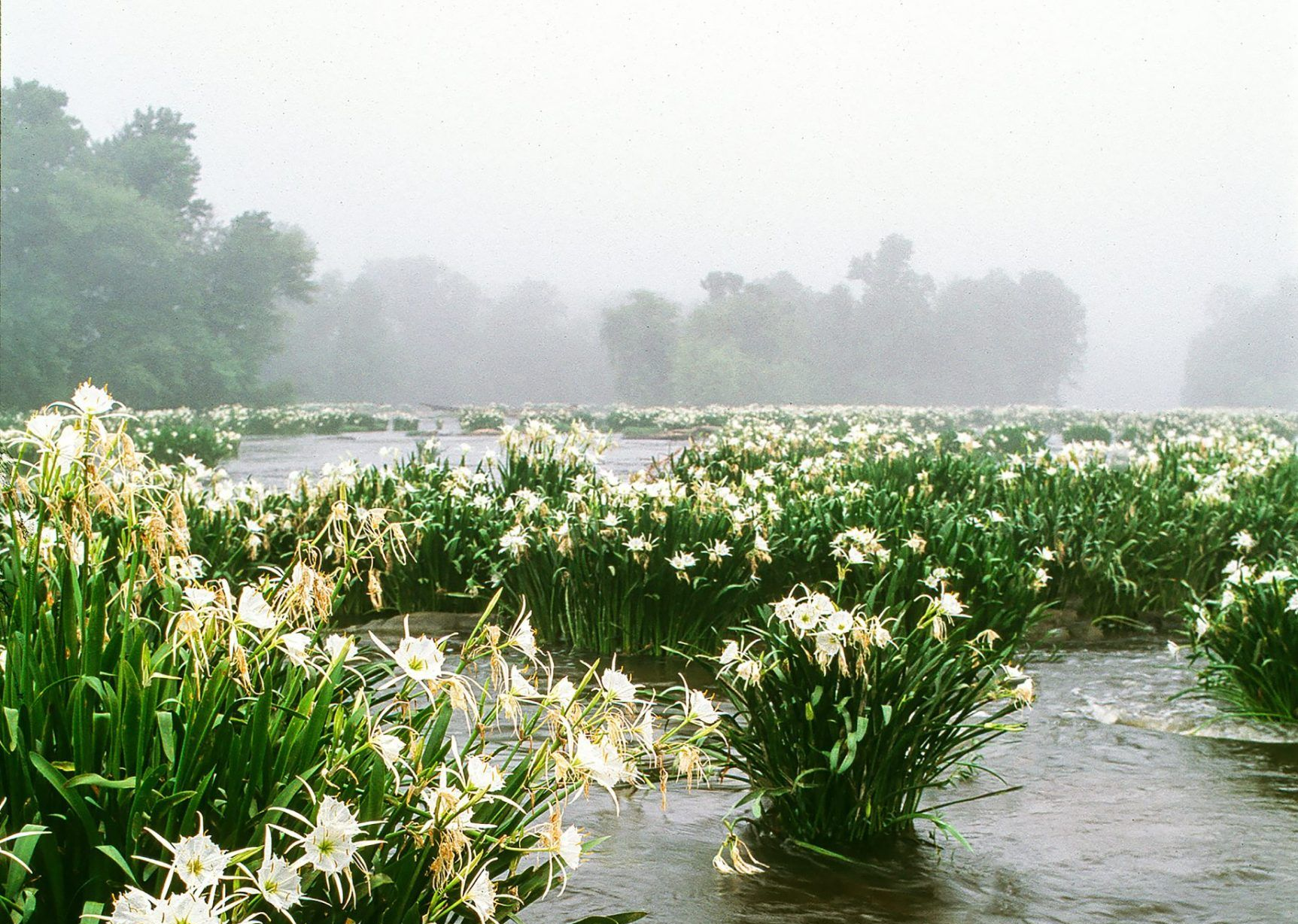
That’s one of the most common questions Riverkeepers get during the summer. To help answer that question, Catawba Riverkeeper operates a summer Swim Guide program to test popular swimming areas on local lakes.


Swim Guide is an international program used by Riverkeepers and other advocates to provide up-to-date recreational water quality data for beaches, lakes, and rivers around the world. Catawba Riverkeeper piloted the program on Lake Wylie in 2019. By 2021, we had expanded the program to 58 sites on the 5 other major lakes – Lake James, Lake Hickory, Lake Norman, Mountain Island Lake, and Lake Wateree – in addition to Lake Wylie.

How does it work?

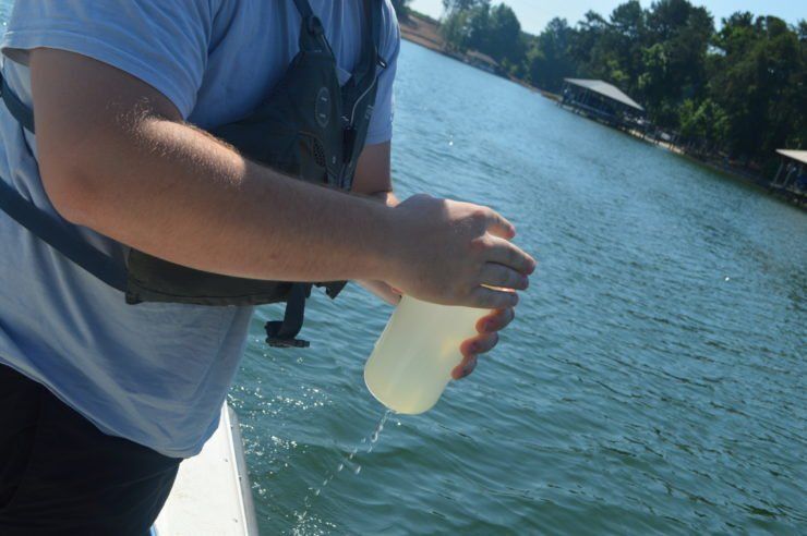
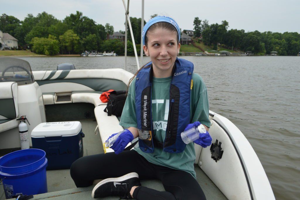
Riverkeeper staff, interns, and volunteers collect samples on Thursday mornings, which are tested for E. coli in the Riverkeeper’s in-house lab. Results are posted on Fridays in a stoplight system (green, yellow, red), so that you can make informed decisions about swimming over the weekend.


Contact lauren.h@catawbariverkeeper.org to learn how you can volunteer!

Why test for E. coli?

Recreational standards usually focus on indicator bacteria, which are used to detect the level of fecal contamination in the water. E.Coli is considered a better indicator of human sewage than other types of bacteria because they are found in intestines of warm blooded animals. E. coli is the type of bacteria that local health authorities look for in freshwater. Primary contact with water containing high levels of fecal bacteria and other pollutants can lead to disease, infection, and rashes.


Results are also be shared on the national Swim Guide map and will follow a stoplight system to help you easily understand results. Locations that come back with high amounts of E. coli will be marked red.

We’re looking for volunteers to drive their boats to designated spots each week. All supplies will be provided and gas will be reimbursed by Catawba Riverkeeper. Learn more and email lauren.h@catawbariverkeeper.org if you’re interested.

Sponsor a site or a lake or river!

Site sponsorships are $500 and cover the cost of materials required to collect samples and run tests weekly for each site. Lake sponsorships are $5,000 and cover the personnel expenses incurred by staff and interns for time and mileage. Select your site or lake by typing in the name of the site or lake after you hit “donate once” on the main giving page. Sponsorship requests are granted on a first come, first served basis. Sites must be chosen from the list of sites on the Swim Guide webpage.

See the sponsored and available sites and lakes or rivers on the map below. We’ll update the map as new sponsors sign up.

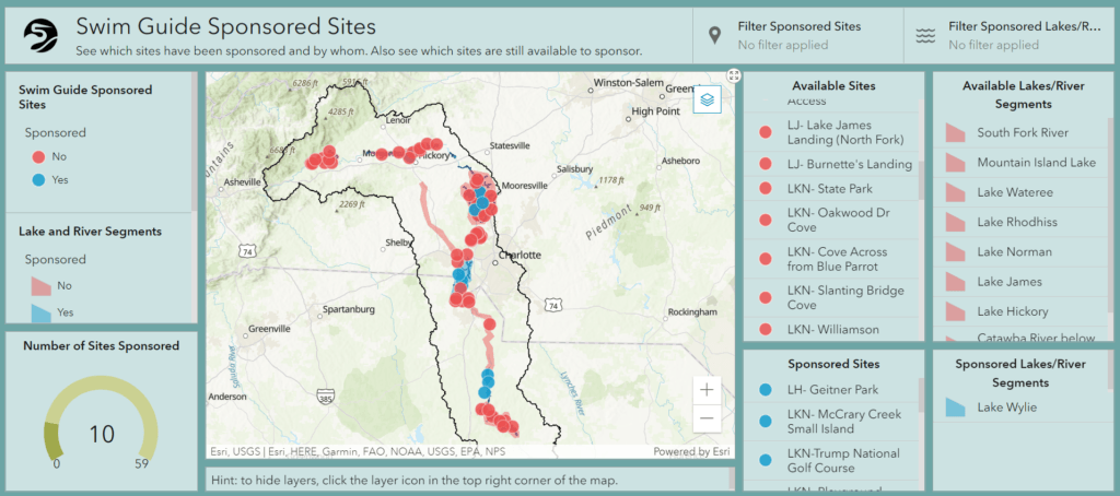
Lake or River Segments for Sponsorship

  • Lake James
  • Lake Rhodhiss
  • Lake Hickory
  • Lake Norman
  • Mountain Island Lake
  • South Fork River
  • Lake Wylie – Sponsored by the Borman Family
  • Free flowing Catawba below Lake Wylie Dam
  • Lake Wateree

The Riverkeeper’s sample data provides a general guide to the health of the waterway and should only be used for informational purposes. This data does not guarantee the sampled area is safe for swimming at all times. Overall, E. coli levels in the Catawba lakes are low, and the reservoirs are typically safe for swimming. However, E. coli levels can change at any time & increase after rain events. As a general rule, if the water is clear, then E. coli levels are likely to be low.

May 27, 2026
On the evening of May 26th, 2026, Catawba Riverkeeper Brandon Jones attended the Charlotte City Council Public Meeting. At this meeting, he shared our organization's comments on the proposed 150-day data center moratorium. These comments can be read below. "The Catawba Riverkeeper Foundation is a member-funded environmental nonprofit that educates, advocates, and protects the Catawba-Wateree River and all its tributaries. Our organization represents over 8,000 active members and nearly 3 million citizens who rely on the watershed for drinking water, recreation, and electricity. We are concerned that the growth of local data centers may overallocate our limited resources and decrease our ability to respond to drought. We appreciate the opportunity to comment on the proposed 150-day moratorium and strongly support the staff's recommendation to adopt it. Additionally, if adopted, we recommend that the study consider a tiered approach, transparency, and net water consumption. For our water resources, the most important data center metric is net water use. A 400 MW facility—like the one now under construction on Moores Chapel Road—may actually evaporate more water indirectly than directly for cooling. The nearby Catawba Nuclear Station uses approximately 30 MGD to produce 2,300 MW or 5.2 MGD from Lake Wylie per 400 MW. However, without transparency and reporting, it is difficult to know the current impact of these data centers and almost impossible to accurately forecast the industry's future. The most accurate forecast of our region's water resources is the Catawba Wateree Water Management Group’s 2026 Integrated Water Resources Plan. Unfortunately, this plan explicitly does not include increases in water use from data centers due to limited reliable information. It is absolutely critical that our community has accurate information. We need full transparency on the planned electrical and water use of large data centers. A ban of nondisclosure agreements between elected officials and developers could help alleviate suspicion and allow communities to make informed decisions about tradeoffs. The potential direct and indirect impact s of a project should be modeled by the CWWMG to determine its actual impacts. Those impacts could be mitigated by funding water conservation projects, as some data centers have already proposed. Once operating, we need reporting on the actual water and energy use. The cumulative impact must be understood to ensure capacity and resiliency. Water withdrawers from the Catawba utilize a Low Inflow Protocol during drought to help stretch the available supply. Large data centers need conservation plans that comply with this plan. It is hypocritical to ask residents and some businesses to restrict water use while permitting facilities that cannot or will not do the same. Most years, there is plenty of water for drinking, irrigation, ecological flows, and industry in the Catawba. However, droughts such as 2001, 2007, and today expose our vulnerabilities. These droughts are more likely in a warming climate, and we are becoming less resilient with a growing population and industrial demands. Sustainable water management requires careful planning and robust coordination between users, including data centers."
By Susannah Bryant March 19, 2026
Greg Nance has had his boots on the ground since the storm subsided.
February 19, 2026
Live staking is a streambank restoration approach that reduces erosion and sediment pollution. This is the practice of planting dormant branch cuttings of native plants along streambanks (also known as riparian zones) to help hold soil in place along the waters' edge. Live stakes are planted along with native plant seeds and shrubs to create riparian buffers, which help prevent sediment from becoming a stream pollutant by securing the soil in place with good root systems. Riparian buffers also filter out other pollutants, such as chemicals, oils, fertilizers, and trash, before they enter our waterways.