Water Quality and Total Suspended Solids

Rachael Rosenstein • January 3, 2023

Little Sugar Creek Water Quality

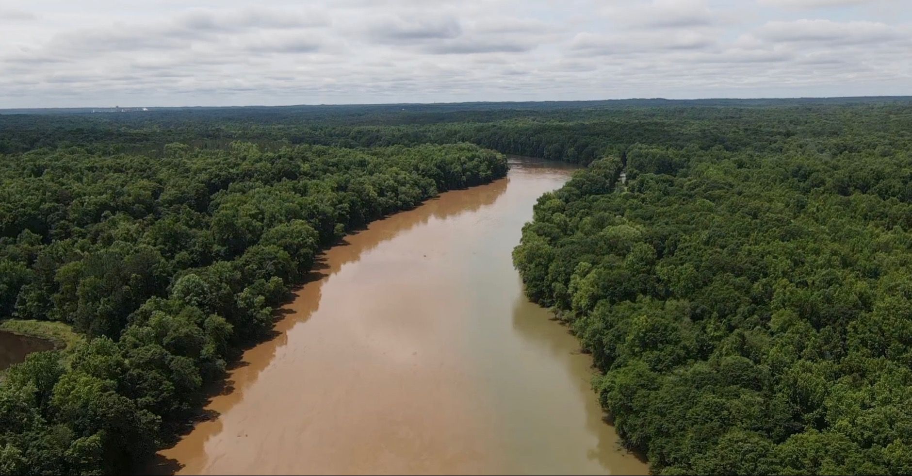
Total Suspended Solids (TSS) (Oct 2022) 

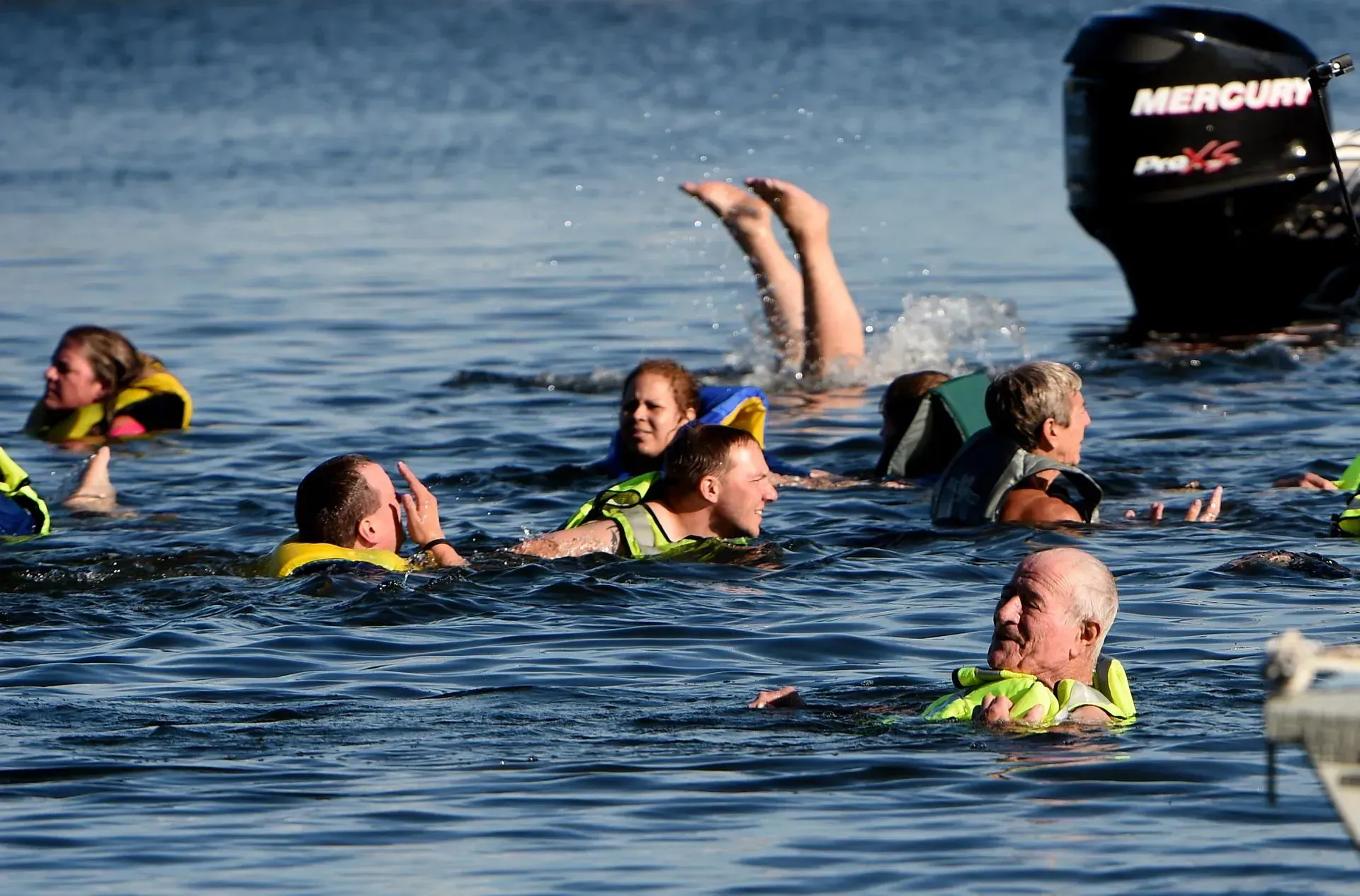
We can’t stress enough how much stormwater impacts the health of our waters! In an effort to continue measuring this throughout the Catawba-Wateree Watersheds, our Riverkeeper Brandon and Southern Basin Watershed Manager Rachael went out to Sugar Creek to take water samples just after Hurricane Ian came through. 


There are many indicators of good or poor water quality, each with their own methods of testing and assessment. One that you all may be familiar with is the E. Coli testing that we do throughout the summer for Swim Guide that lets us tell you whether or not the water is safe to swim in. Another indicator of water quality is provided through measuring total suspended solids (TSS) -- this is what Brandon and Rachael were sampling for. Per the United States Geological Survey (USGS), TSS is used to numerically measure concentrations of suspended organic and inorganic particles in surface water. Put a little more simply, TSS includes anything living or non-living that gets mixed up or floats around in waters that you can see above ground (creeks, rivers, etc.). With our lab equipment, we can measure these types of particles down to 2 microns in size – to help put that in perspective, a grain of table salt is 120 microns! And yes, stuff that small matters! 


A high TSS concentration indicates poor water quality for several reasons. Most basically, it means there is a lot of stuff in the water, and typically that is not a good thing. Take for example a mountain stream with water so clear that you can see minnows, other fish, lots of bugs, crayfish, etc. There is a good chance that the TSS there is going to be low. Compare that to most any of our urban water after a rainstorm when it looks brownish, reddish, muddy, and you can’t see a thing in there, the TSS would likely be high. 


An increase in TSS during and after rain events is natural, but the amount and significance vary as a result of human activity. A forest stream will see a slightly higher rate as the bottom gets stirred up, dirt from the banks flows in, etc., but the surrounding plants do a great job of filtering out a lot of what otherwise could end up in the waterbody. In contrast, an urban area would include runoff from buildings, construction sites, highways, parking lots, etc., all of which contain materials that contribute to TSS in the water. 


To tie all of this back to why we chose to sample Sugar Creek, it is because it’s the main waterbody that is directly fed by runoff that flows through the greater Charlotte area and ultimately into the Catawba and Wateree Rivers in South Carolina. This means that a drop of water falling onto a construction site in Charlotte will flow through our entire Southern Basin and wind up all the way at the confluence with the Congaree River. 


How does this impact you? Well, one drop of water carrying dirt wouldn’t, but the volume of water when it rains over this large land area contributes significantly to our water quality. The more stuff that is in the water, the higher the turbidity (a fancy way of saying how clear or not the water is – low turbidity is clear water, high turbidity is murky). This causes a reduction in visibility and increase in light absorption which can increase stream temperatures, decrease dissolved oxygen levels, limit aquatic plant growth, and harm aquatic animal life. Those drops of water can also contain chemicals, microplastics, E. Coli, and heavy metals like mercury that make the water unsafe for human contact and consumption. 


What were the results of our sample? After collecting the water, we ran it through a filter to measure the weight of solids per volume of water, also known as Total Suspended Solids or TSS. Our calculations showed that about 10 shipping containers worth (650 cubic meters) of sediment is eroding from Mecklenburg County and moving down Sugar Creek with each major storm. 


May 27, 2026
On the evening of May 26th, 2026, Catawba Riverkeeper Brandon Jones attended the Charlotte City Council Public Meeting. At this meeting, he shared our organization's comments on the proposed 150-day data center moratorium. These comments can be read below. "The Catawba Riverkeeper Foundation is a member-funded environmental nonprofit that educates, advocates, and protects the Catawba-Wateree River and all its tributaries. Our organization represents over 8,000 active members and nearly 3 million citizens who rely on the watershed for drinking water, recreation, and electricity. We are concerned that the growth of local data centers may overallocate our limited resources and decrease our ability to respond to drought. We appreciate the opportunity to comment on the proposed 150-day moratorium and strongly support the staff's recommendation to adopt it. Additionally, if adopted, we recommend that the study consider a tiered approach, transparency, and net water consumption. For our water resources, the most important data center metric is net water use. A 400 MW facility—like the one now under construction on Moores Chapel Road—may actually evaporate more water indirectly than directly for cooling. The nearby Catawba Nuclear Station uses approximately 30 MGD to produce 2,300 MW or 5.2 MGD from Lake Wylie per 400 MW. However, without transparency and reporting, it is difficult to know the current impact of these data centers and almost impossible to accurately forecast the industry's future. The most accurate forecast of our region's water resources is the Catawba Wateree Water Management Group’s 2026 Integrated Water Resources Plan. Unfortunately, this plan explicitly does not include increases in water use from data centers due to limited reliable information. It is absolutely critical that our community has accurate information. We need full transparency on the planned electrical and water use of large data centers. A ban of nondisclosure agreements between elected officials and developers could help alleviate suspicion and allow communities to make informed decisions about tradeoffs. The potential direct and indirect impact s of a project should be modeled by the CWWMG to determine its actual impacts. Those impacts could be mitigated by funding water conservation projects, as some data centers have already proposed. Once operating, we need reporting on the actual water and energy use. The cumulative impact must be understood to ensure capacity and resiliency. Water withdrawers from the Catawba utilize a Low Inflow Protocol during drought to help stretch the available supply. Large data centers need conservation plans that comply with this plan. It is hypocritical to ask residents and some businesses to restrict water use while permitting facilities that cannot or will not do the same. Most years, there is plenty of water for drinking, irrigation, ecological flows, and industry in the Catawba. However, droughts such as 2001, 2007, and today expose our vulnerabilities. These droughts are more likely in a warming climate, and we are becoming less resilient with a growing population and industrial demands. Sustainable water management requires careful planning and robust coordination between users, including data centers."
By Susannah Bryant March 19, 2026
Greg Nance has had his boots on the ground since the storm subsided.
February 19, 2026
Live staking is a streambank restoration approach that reduces erosion and sediment pollution. This is the practice of planting dormant branch cuttings of native plants along streambanks (also known as riparian zones) to help hold soil in place along the waters' edge. Live stakes are planted along with native plant seeds and shrubs to create riparian buffers, which help prevent sediment from becoming a stream pollutant by securing the soil in place with good root systems. Riparian buffers also filter out other pollutants, such as chemicals, oils, fertilizers, and trash, before they enter our waterways.