Mural Unveiled at Confluence

March 18, 2024

Local artist completes mural and map of Catawba-Wateree River Basin

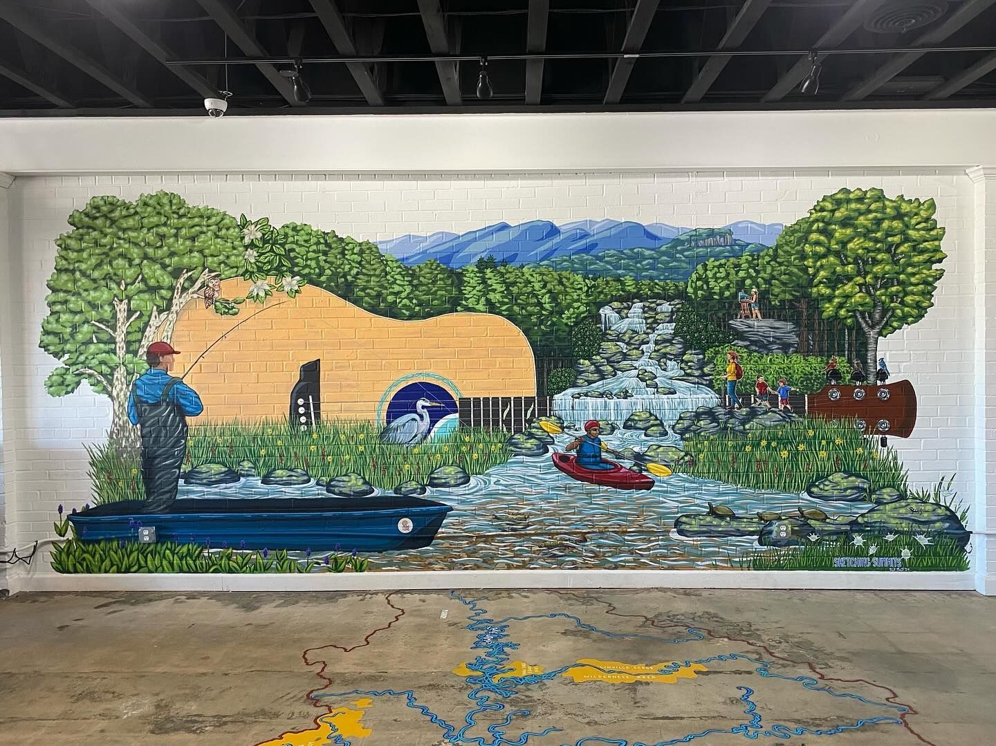
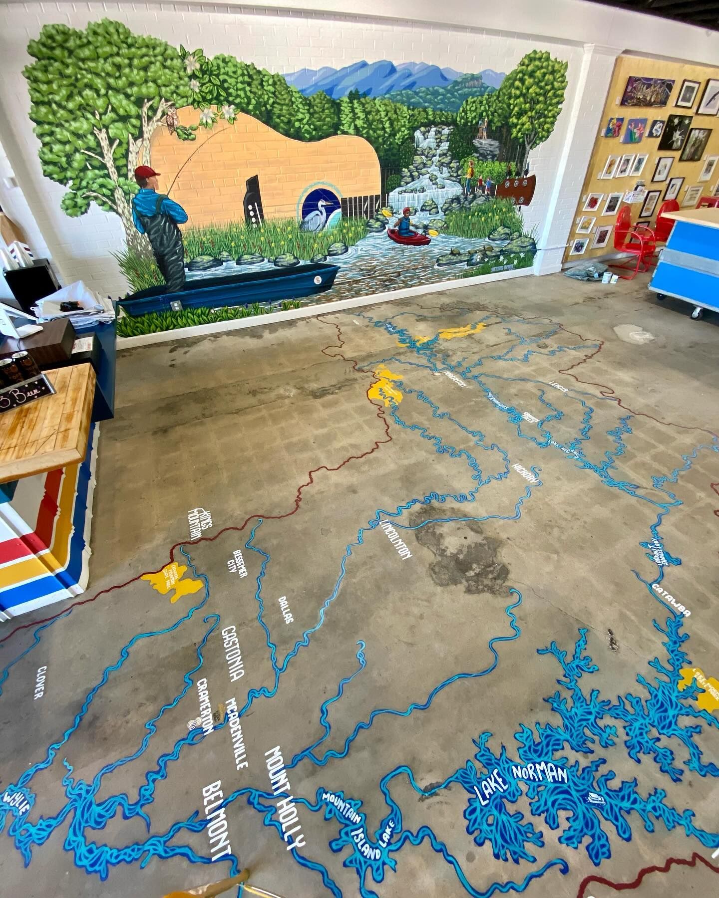
Local artist and avid hiker, Heidi Nisbett (@sketchingsummits), has captured the beauty of the Carolinas along the Catawba-Wateree River Basin with her awe-inspiring 20x8 ft wall mural connected by a to scale floor map of the major waterways within the basin at our community engagement space located in Cramerton, NC called Confluence.   


The wall mural depicts iconic locations within our 5,610 square mile river basin, including the Black Mountains and Table Rock of Linville Gorge, Catawba Falls and more, while the floor mural highlights major waterways within our 5-basin footprint. 


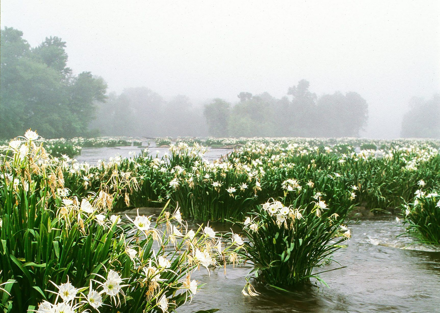
Throughout both the wall and the floor portions of this mural, 22 native species can be detected. These include the Rocky Shoals Spider Lilies at Landsford Canal (located in our Southern Basin and one of our most popular stops within our guided eco-tour series), Bigleaf Magnolias, Brook Trout and more. Most of these species are plants and wildlife that Heidi has encountered while hiking in locations around the basin’s boundaries. If you look closely, you may even be able to spot the artist herself within the wall mural. 


If you have not seen this mural up close and in person yet, what are you waiting for? A photo of these pieces does not do it justice! 

Come out to Confluence to enjoy live music, drink a local draft beer, and admire other remarkable artwork from local talents. To see upcoming events, visit https://www.confluencesouthfork.org/calendar


Thanks to our friends at Sticker Mule and their custom stickers​, you can also take this artwork home with you with our limited-edition mural sticker.  All proceeds go back to preserve, protect, and restore the waters of the Catawba-Wateree River basin for all through education, advocacy, and engagement. 


By Madison Washington June 11, 2026
Native to South America, alligator weed has become a widespread invasive species along the East Coast, rapidly spreading through waterways, wetlands, and shorelines. Its aggressive growth disrupts ecosystems by outcompeting native vegetation, reducing habitat quality for wildlife, and creating challenges for recreation, water management, and local communities.
May 27, 2026
On the evening of May 26th, 2026, Catawba Riverkeeper Brandon Jones attended the Charlotte City Council Public Meeting. At this meeting, he shared our organization's comments on the proposed 150-day data center moratorium. These comments can be read below. "The Catawba Riverkeeper Foundation is a member-funded environmental nonprofit that educates, advocates, and protects the Catawba-Wateree River and all its tributaries. Our organization represents over 8,000 active members and nearly 3 million citizens who rely on the watershed for drinking water, recreation, and electricity. We are concerned that the growth of local data centers may overallocate our limited resources and decrease our ability to respond to drought. We appreciate the opportunity to comment on the proposed 150-day moratorium and strongly support the staff's recommendation to adopt it. Additionally, if adopted, we recommend that the study consider a tiered approach, transparency, and net water consumption. For our water resources, the most important data center metric is net water use. A 400 MW facility—like the one now under construction on Moores Chapel Road—may actually evaporate more water indirectly than directly for cooling. The nearby Catawba Nuclear Station uses approximately 30 MGD to produce 2,300 MW or 5.2 MGD from Lake Wylie per 400 MW. However, without transparency and reporting, it is difficult to know the current impact of these data centers and almost impossible to accurately forecast the industry's future. The most accurate forecast of our region's water resources is the Catawba Wateree Water Management Group’s 2026 Integrated Water Resources Plan. Unfortunately, this plan explicitly does not include increases in water use from data centers due to limited reliable information. It is absolutely critical that our community has accurate information. We need full transparency on the planned electrical and water use of large data centers. A ban of nondisclosure agreements between elected officials and developers could help alleviate suspicion and allow communities to make informed decisions about tradeoffs. The potential direct and indirect impact s of a project should be modeled by the CWWMG to determine its actual impacts. Those impacts could be mitigated by funding water conservation projects, as some data centers have already proposed. Once operating, we need reporting on the actual water and energy use. The cumulative impact must be understood to ensure capacity and resiliency. Water withdrawers from the Catawba utilize a Low Inflow Protocol during drought to help stretch the available supply. Large data centers need conservation plans that comply with this plan. It is hypocritical to ask residents and some businesses to restrict water use while permitting facilities that cannot or will not do the same. Most years, there is plenty of water for drinking, irrigation, ecological flows, and industry in the Catawba. However, droughts such as 2001, 2007, and today expose our vulnerabilities. These droughts are more likely in a warming climate, and we are becoming less resilient with a growing population and industrial demands. Sustainable water management requires careful planning and robust coordination between users, including data centers."
By Susannah Bryant March 19, 2026
Greg Nance has had his boots on the ground since the storm subsided.