2023 Wateree River Survey

November 8, 2023


3 days. 2 nights. 76.25 miles paddled. 31 alligators.


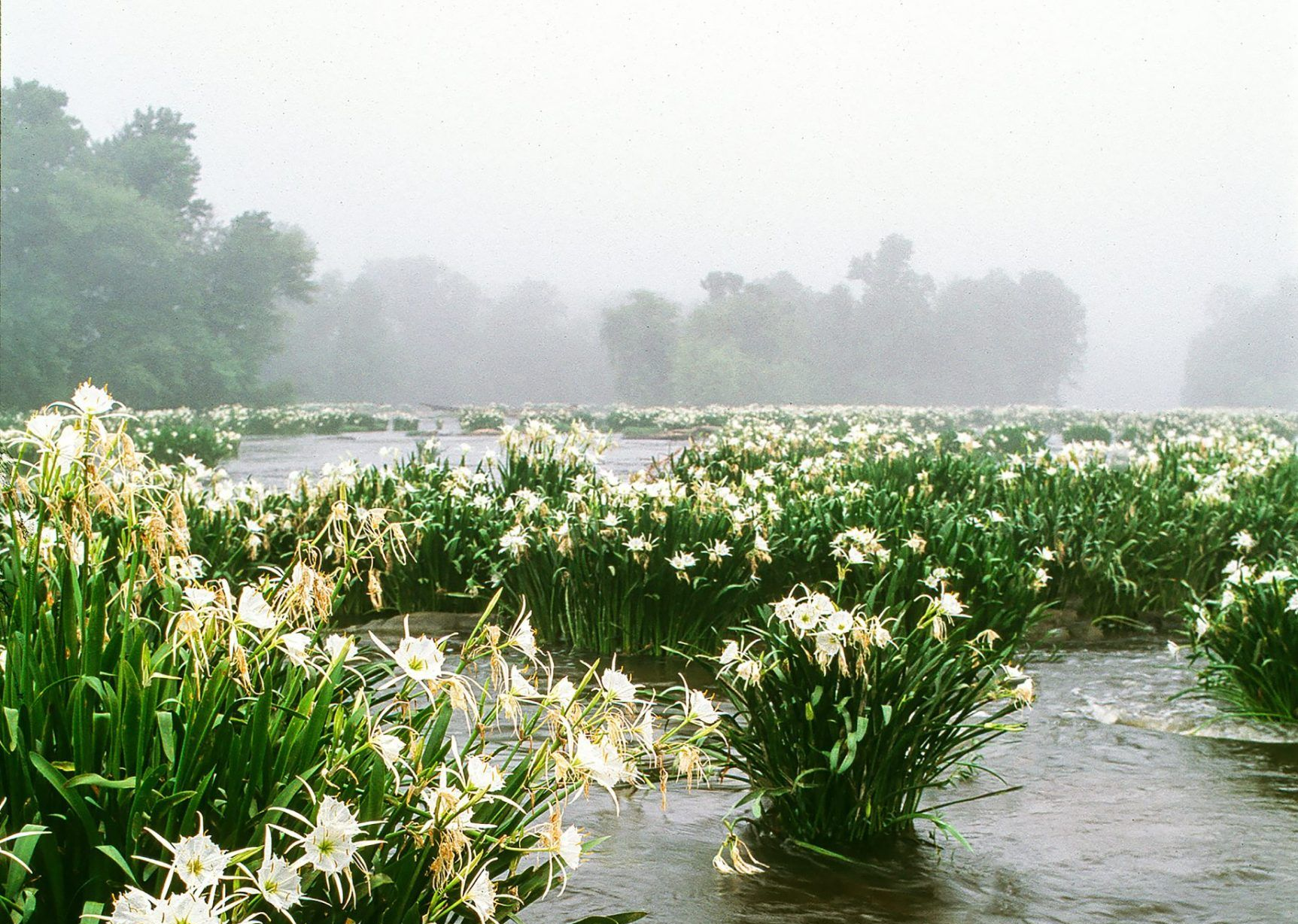
The Wateree River runs 80 miles through Kershaw, Sumter, and Richland counties in South Carolina. Currently, this is the least developed part of our basin, though that could change due to continued development and the expansion of cities in the area. It is difficult to assess many parts of the river due to limited public access points and its remote location. 


Rachael, our Southern Basin Watershed Manager, Brandon, our Riverkeeper, and Ryan, our Policy Manager, recently embarked on a 3-day, 2-night paddle survey of the Wateree River. Each year, we do a survey of this section of the river to gather more information and discover new issues we may need to address. 


Summary of the paddle  

Day 1: They began their journey with a 24.75-mile paddle. 


Day 2: Day two brought overcast skies and winds. They paddled 32 miles, taking advantage of having a break from the sun. 


Day 3: They covered 19.5 miles. The final day was challenging, with a strong sun, dozens of gators, and a low current down the Wateree River. The last two miles were spent paddling up the Congaree River. 


Observations and takeaways 

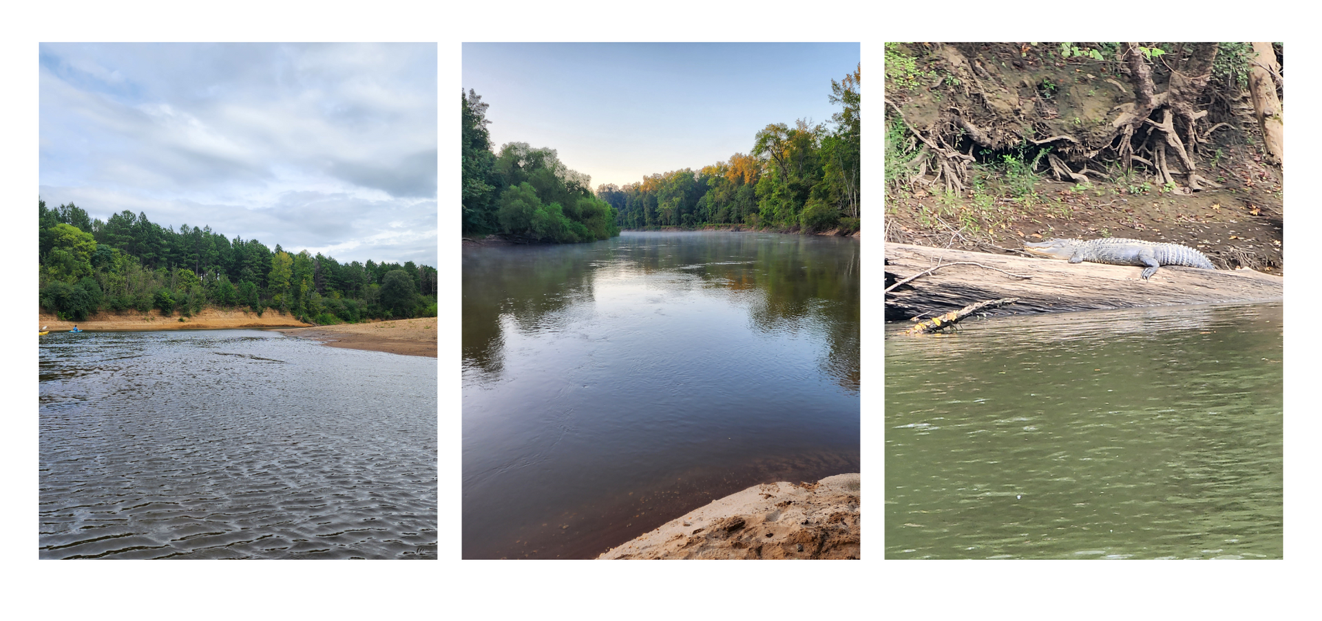
A frequent observation during the survey was that the Wateree River is actively meandering (click here for more information about what causes streams to meander). Despite the upstream dams and mostly regulated flows, there are many areas with steep riverbanks and active cuts. The Wateree River has constantly eroding banks, depositing sand bars, and even creating new oxbow lakes.  These findings highlight the need for buffers, among other preservation and restoration work, to protect both water quality and infrastructure. Our team observed agricultural fields, logging roads, and homes precariously close to actively eroding cut banks. While some property owners have attempted to slow this process via armoring the river channel with concrete and rock, this is a temporary solution which is both expensive and not sustainable. 


They also encountered over 30 alligators during the three days. 


The Wateree River is a designated Blue Trail. Unfortunately, due to its dynamic nature and general remoteness, much of the online information is outdated or incomplete. We are working with partners to help make it an easier trip for others who are interested in exploring this beautiful part of the river. 


May 27, 2026
On the evening of May 26th, 2026, Catawba Riverkeeper Brandon Jones attended the Charlotte City Council Public Meeting. At this meeting, he shared our organization's comments on the proposed 150-day data center moratorium. These comments can be read below. "The Catawba Riverkeeper Foundation is a member-funded environmental nonprofit that educates, advocates, and protects the Catawba-Wateree River and all its tributaries. Our organization represents over 8,000 active members and nearly 3 million citizens who rely on the watershed for drinking water, recreation, and electricity. We are concerned that the growth of local data centers may overallocate our limited resources and decrease our ability to respond to drought. We appreciate the opportunity to comment on the proposed 150-day moratorium and strongly support the staff's recommendation to adopt it. Additionally, if adopted, we recommend that the study consider a tiered approach, transparency, and net water consumption. For our water resources, the most important data center metric is net water use. A 400 MW facility—like the one now under construction on Moores Chapel Road—may actually evaporate more water indirectly than directly for cooling. The nearby Catawba Nuclear Station uses approximately 30 MGD to produce 2,300 MW or 5.2 MGD from Lake Wylie per 400 MW. However, without transparency and reporting, it is difficult to know the current impact of these data centers and almost impossible to accurately forecast the industry's future. The most accurate forecast of our region's water resources is the Catawba Wateree Water Management Group’s 2026 Integrated Water Resources Plan. Unfortunately, this plan explicitly does not include increases in water use from data centers due to limited reliable information. It is absolutely critical that our community has accurate information. We need full transparency on the planned electrical and water use of large data centers. A ban of nondisclosure agreements between elected officials and developers could help alleviate suspicion and allow communities to make informed decisions about tradeoffs. The potential direct and indirect impact s of a project should be modeled by the CWWMG to determine its actual impacts. Those impacts could be mitigated by funding water conservation projects, as some data centers have already proposed. Once operating, we need reporting on the actual water and energy use. The cumulative impact must be understood to ensure capacity and resiliency. Water withdrawers from the Catawba utilize a Low Inflow Protocol during drought to help stretch the available supply. Large data centers need conservation plans that comply with this plan. It is hypocritical to ask residents and some businesses to restrict water use while permitting facilities that cannot or will not do the same. Most years, there is plenty of water for drinking, irrigation, ecological flows, and industry in the Catawba. However, droughts such as 2001, 2007, and today expose our vulnerabilities. These droughts are more likely in a warming climate, and we are becoming less resilient with a growing population and industrial demands. Sustainable water management requires careful planning and robust coordination between users, including data centers."
By Susannah Bryant March 19, 2026
Greg Nance has had his boots on the ground since the storm subsided.
February 19, 2026
Live staking is a streambank restoration approach that reduces erosion and sediment pollution. This is the practice of planting dormant branch cuttings of native plants along streambanks (also known as riparian zones) to help hold soil in place along the waters' edge. Live stakes are planted along with native plant seeds and shrubs to create riparian buffers, which help prevent sediment from becoming a stream pollutant by securing the soil in place with good root systems. Riparian buffers also filter out other pollutants, such as chemicals, oils, fertilizers, and trash, before they enter our waterways.